Running the Red Centre: A Guide to Uluru's Base Run
Routes | Published 2026-01-30 | By Sam
10.6km around Uluṟu at first light. What the base run is like, kilometre by kilometre, and what Aṉangu ask of you while you're there.
OUTRN acknowledges the Aṉangu people as the Traditional Owners of the land upon which we will run and explore. We pay our respects to their Elders past, present, and emerging. We run with respect for the Tjukurpa (law/culture) and the land.
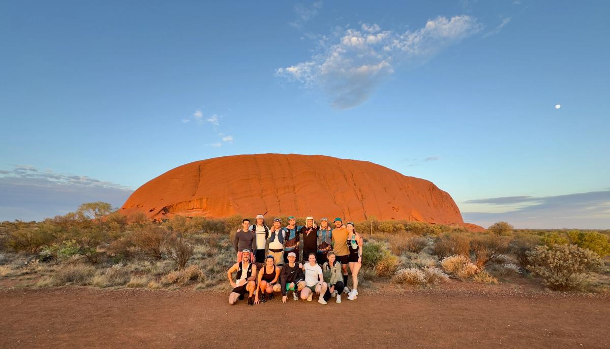
Imagine this. It's 6am and you're in the dark at the Mala car park with 13 mates, kilometres from the nearest city, waiting for enough light to run by. That was us in September 2024. No OUTRN, no event, nobody timing anything. A group of friends who'd flown to the middle of Australia to run around Uluṟu at sunrise. Would you believe me if I told you that's the morning that started all of this?
Here's what the run is like.
The First Kilometre Changes You
The first thing you notice is the sound. Red sand under your shoes, a bit of gravel, and nothing else. No traffic, no one talking.
The rock is on your right and it is 348 metres high. Photos don't do that. The sandstone was laid down around 550 million years ago. You've been running since your twenties.
The base walk is 10.6km around the rock, flat and well marked, compacted sand with the odd rock slab. As a running route it's easy. Nobody comes here for the workout.
What to Expect, Kilometre by Kilometre
Km 0–1: Mala
From the car park the track runs tight to the rock. Kaṉtju Gorge is a kilometre in, sheer walls on three sides and a pool at the bottom after rain. The Mala story belongs here. Read the signs. The rangers tell it properly on the free morning walk, 10am from May to September, which is worth coming back for.
Wide, firm sand. Tour groups arrive mid-morning. At first light it's you and a few walkers.
Follow the base walk markers clockwise. Parks recommends it and the stories around the base run that way.
Km 1–5.5: North-east face
The trail pulls back from the rock and the shade goes with it. This is the face you see from the resort, from the plane, from every Field of Light photo, and it is the most culturally sensitive part of the park. Aṉangu ask for no photographs of it at all. Put the phone in the vest and run it.
Packed sand, a few slabs. Nothing technical.
Km 5.5–6.5: Kuniya and Muṯitjulu
Round Kuniya Piti at the eastern tip and the track swings along the south side. Muṯitjulu Waterhole is a few hundred metres off the loop, a permanent waterhole with rock art under the overhang. Stop. Walk in. Read the signs, keep the camera down where they say, and leave it as you found it. The Kuniya and Liru story lives here, and Aṉangu tell it at the Cultural Centre.
More trees here, mulga and desert oak, and the first real shade since the Mala caves.
Km 6.5–8.5: Lungkaṯa
The quiet side. The rock slopes down to meet the path, there are caves overhead full of small birds, and most mornings there's nobody else on it. If the sun's up this is where you watch the face go orange. There are signed no-photo sites along here as well. Same rule.
Sandy the whole way. Softer, not slow.
Km 8.5–10.6: Back to Mala
The track widens, the boardwalk comes back, and you can hear the car park before you see it. Toilets and a bubbler. Go again if you're going again.
Why Run Here
Aṉangu call their law and culture Tjukurpa. It isn't ours to explain and it isn't something you pick up in a lap. What they ask of visitors is simple: listen, learn, stay on the track, don't photograph the signed sites, and share what you learnt when you get home. That's the deal, and it's a good one.
Run it slow. Conversational pace means you see the colour change, you see the birds, you read the signs. Nobody's timing you.
Practical Information
Best Time to Run
May to September. Days 20 to 30°C, cold nights, fewer flies.
October to March is 35°C plus most days and over 40 often. Parks asks you to be off every track by 11am and closes sections of the base walk when the forecast hits 40°C. Don't run here in the middle of a summer day.
Time of day: first light. The park gates open at 6am in May and 6:30am in June and July, and Mala is 20 minutes inside the gate, so plan around the gate, not a sunrise app.
Water and Facilities
There is water on the trail, but only near the halfway mark. On that first morning we each carried a 750ml flask and topped up there, which was plenty for a single dawn lap in the cool. For a running pace in any real warmth, or if you are doing more than one lap, carry at least 1.5 litres and treat the halfway bubbler as a bonus, not a plan. The Mala car park has toilets and a water bubbler for refilling.
Kuniya car park and the Cultural Centre also have water if you're breaking the loop up.
Park Entry
The park pass is $38 for three consecutive days. Buy it online before you arrive and have it on your phone at the gate.
Getting There
Ayers Rock Airport (AYQ) is 20 minutes from the park gate. Yulara, where every bed is, sits just outside the boundary. You need a car or a transfer to get to Mala, and in the dark.
Safety Considerations
- Heat: after 9am in the warm months you're in trouble. Be finished.
- Sun: no shade for about eight of the ten kilometres. Sunscreen, hat, sunglasses.
- Signal: patchy. Tell someone your plan and your finish time. There are emergency call devices at Mala and on the loop.
- Snakes: here, rarely seen. Another reason to stay on the track.
The Feeling You Take Home
No climbing, no technical track, nothing to chase on Strava. Ten and a half kilometres on red sand around a rock that has been there a very long time, on land that belongs to people who have been here a very long time too.
You'll be done before the resort has finished serving breakfast. Then go to the Cultural Centre and listen for an hour. The run makes more sense after.
Recommended gear
- Lightweight trail shoes
- Hydration vest (1.5L minimum)
- Sunscreen
- Hat with neck protection, or a buff
- A head torch for the walk in
- Camera, and know where you can't point it